Rumkale is a striking medieval fortress in the Yavuzeli district of Gaziantep, rising on a steep rocky headland surrounded on three sides by water, at the point where the Merzuman Stream joins the Euphrates. With its superimposed layers reaching from Rome to Byzantium, from the Armenian Catholicosate to the Crusaders and the Mamluks, Rumkale is one of the most frequently contested fortresses in the region; today, because of the waters raised by the Birecik Dam, it is most often visited by boat tour from the Halfeti shore.
Since the fortress lies on the shore directly opposite the Halfeti district of Şanlıurfa, these two places are often mentioned together on the same travel route. Rumkale is one of the most distant and most photogenic stops in our Castles category, which gathers together Gaziantep's historic defensive structures; this page covers the fortress's location, its deep history and how it is visited today.
A Strategic Rocky Setting
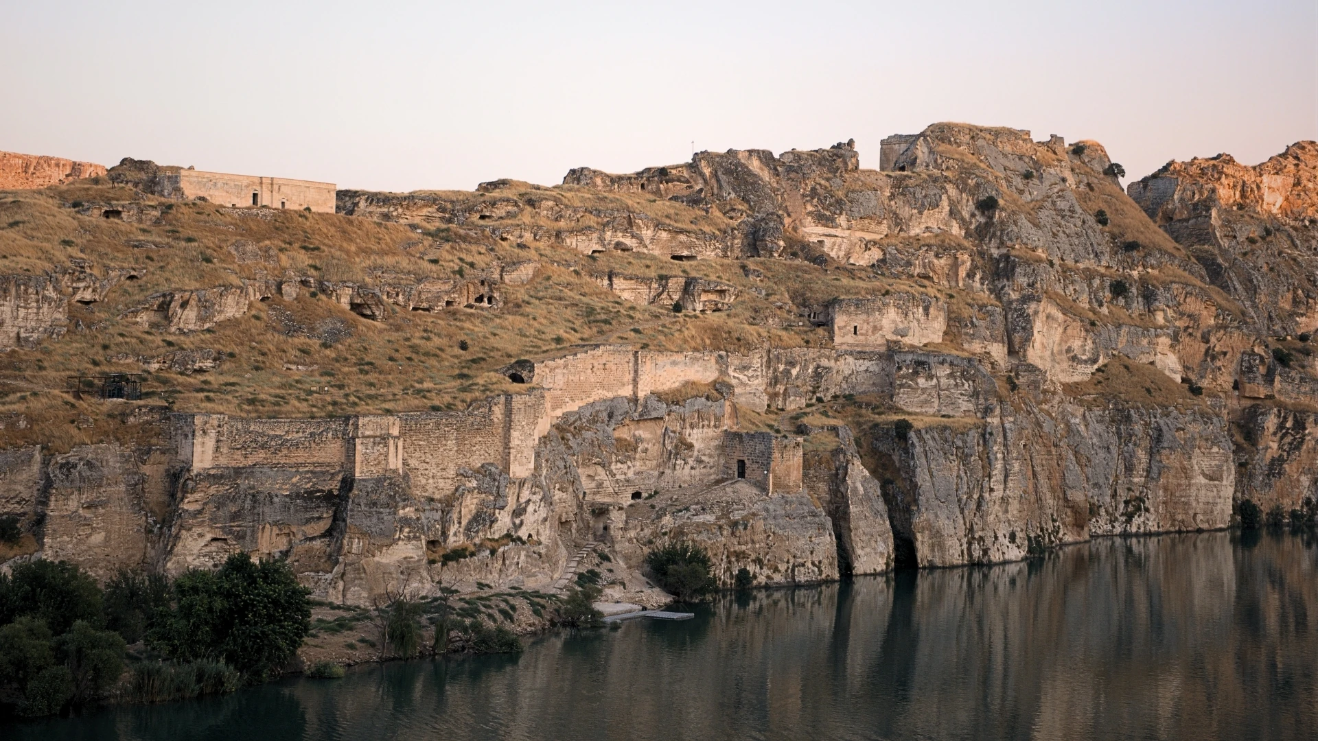
Rumkale's whole importance comes from its naturally defensible position. The fortress is built on a headland covered in high rocks, at the point where the Merzuman Stream (Merzimen) flows into the Euphrates. This position protects the fortress with water on three sides and with steep cliffs on the remaining side; historical sources also note that the structure was surrounded by a multi-tiered system of walls.
According to information provided by the Yavuzeli District Governorate, the fortress lies about 62 kilometres from the centre of Gaziantep and about 25 kilometres from the centre of the Yavuzeli district. The Euphrates, which passes below it, served both as the fortress's natural moat and as the source of water that sustained it over the centuries.
From Rome to the Mamluks: The Layers of a Frontier Fortress
The name Rumkale means "the fortress of the Romans/Byzantines"; throughout history the fortress has been known by names reflecting this meaning in different languages. In Armenian sources it appears as Hromgla (Hromklay), and in Arabic sources as Qal'at ar-Rum. The foundations of the structure can be traced back to the Byzantine period; in this era the fortress is accepted to have been the seat of a Syriac Orthodox (Jacobite) bishopric.
In the 12th century the region came within the sphere of influence of the Crusader county centred on Urfa (Edessa), and the fortress passed for a time into Crusader control. These eventful centuries, which lasted until the Mamluk conquest, made Rumkale a strategic position right on the frontier line between Muslim and Christian powers, one that changed hands again and again.
The Mamluk Conquest and the Ottoman Period
The fortress's Christian period came to a close with the Mamluk conquest at the end of the 13th century. The Egyptian Mamluk sultan al-Malik al-Ashraf Khalil ibn Qalawun captured the fortress after a long siege; sources generally give the date of this conquest as 1292 (1293 in some sources). Ashraf Khalil had the fortress repaired and reorganised it as a frontier stronghold, giving it the name Qal'at al-Muslimin, meaning "the Fortress of the Muslims." In the 16th century, with the end of Mamluk rule after the Battle of Marj Dabiq (1516), Rumkale was incorporated into Ottoman territory.
The Seat of the Armenian Catholicosate: Hromgla
Rumkale's most brilliant and best-known period was its role as the religious centre of the Armenian Church in the Middle Ages. In the mid-12th century the fortress was purchased in order to provide a secure centre for the Armenian Catholicosate/patriarchate; sources associate this purchase with Catholicos Gregory III. Although the year in which the fortress was acquired for the Armenian Catholicosate differs among sources, they agree that the structure became the centre of the Armenian Church from the middle of the 12th century onward.
In this process Rumkale became identified with one of the most respected churchmen of the age, the poet and theologian Catholicos Nerses IV (Shnorhali / "Nerses the Gracious"). According to the sources, Nerses IV served as Armenian Catholicos at the fortress and died there in 1173. From that date the fortress remained the principal centre of the Armenian Catholics for many decades. It is also recorded that religious councils were convened at Rumkale between the Armenian Church and the Byzantine Church to discuss the union of the churches.
The Armenian Catholicosate's period at Rumkale ended with the Mamluk siege at the close of the 13th century. After the fortress fell, the office of the Catholicosate was moved to Sis in Cilicia (present-day Adana–Kozan) and remained there for a long time. Rumkale thus ceased to be a Christian centre of pilgrimage and administration and was transformed into an Islamic frontier fortress.
Rock-Cut Structures: Church, Cistern and Tunnels
Rumkale is not merely a defensive structure made up of walls; it is a settlement largely shaped by carving into the rock. Among the principal structures still traceable within the fortress today are the Church of Saint Nerses, the Barshawma Monastery, water cisterns, caves and a water shaft descending to the river.
The Church of Saint Nerses takes its name from Catholicos Nerses IV mentioned above; sources state that the church was built in the 12th century. The Barshawma Monastery, for its part, dates to the 13th century and takes its name from a Syriac (Jacobite) saint.
The most striking engineering feature of the fortress is its water system cut into the rock. According to the sources, the rock-cut well/tunnel descends about 75 metres from the top of the fortress down to the water level of the Euphrates and was made to draw water directly from the river. This deep, rock-cut descent was a vital solution that freed the fortress from dependence on outside water under siege conditions, and it stands out as one of the elements that made Rumkale's long periods of resistance possible.
Rumkale Today: The Birecik Dam and the Boat Tour
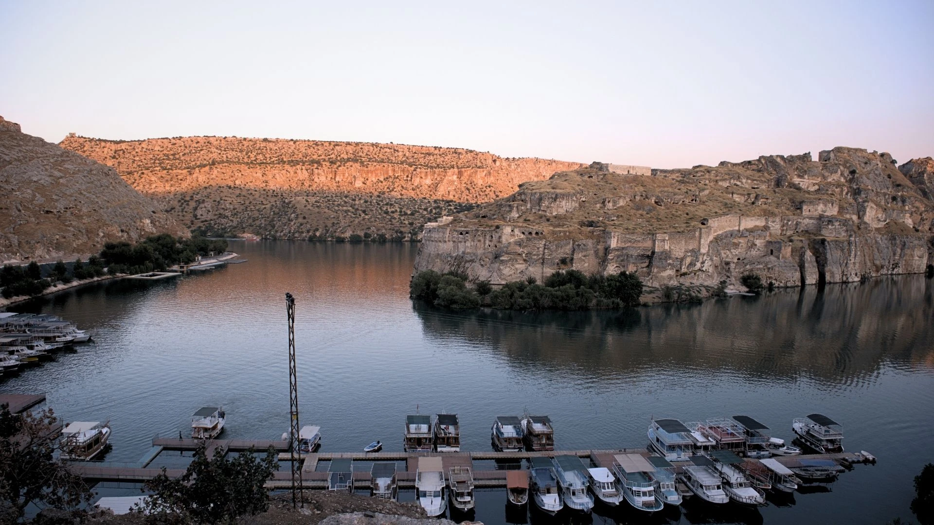
The surroundings of Rumkale changed radically because of the Birecik Dam, which came into service in 2000. The Euphrates waters raised by the dam filled the valley at the foot of the fortress; today the fortress has taken on the dramatic appearance of a rocky island surrounded on three sides by the reservoir. For this reason, access to the fortress by road has largely come to an end, and boat transport has become central to a visit.
Today visitors mostly tour Rumkale by boats departing from Halfeti on the opposite shore. The Rumkale boat tour on the reservoir is part of a Euphrates excursion that also includes stops such as the now largely submerged old Halfeti and the village of Savaşan (Beresül). Approached by boat, the fortress takes on its most impressive appearance, with its rocky mass rising straight out of the water.
For those who wish to plan together Gaziantep's other natural and cultural stops tied to the water and the river, the Halfeti and Euphrates pages are complementary guides; for the region's other defensive structures, you can look at the Castles category.
Rumkale Festival: Water Sports at the Foot of the Castle
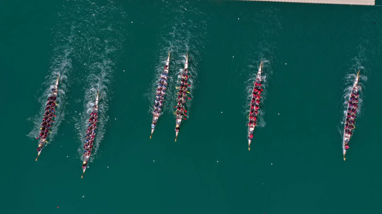
For most of the year Rumkale is a quiet place. Below the rock there is little to hear but the drone of passing boat engines. In early autumn that quiet gives way to the slap of paddles and cheering from the bank. The Rumkale Festival, organised by Gaziantep Metropolitan Municipality, is a water-sports festival held on the bank facing the castle. It was first held in 2017 as the Rumkale Water Sports Festival, and the number of competitors in its races has since reached the thousands.
The centrepiece, run every year since the first, is the dragon boat race. Crews in long, dragon-headed boats paddle in unison on the still arm of water where the Merzuman Stream meets the Euphrates, and the Türkiye Dragon Boat Championship has been held here. Open-water swimmers race over the same stretch, and in some years canoe and water polo events join the programme. Then there are the shows. Flyboarders shoot up on jets of water beneath the sheer rock walls, and there are jet-ski and water-skiing displays as well. Over time the festival has spread onto land too, with hiking, cycling tours and camping.
At the opening of the first festival, the record-holding free diver Şahika Ercümen dived to 40 metres in the waters below the castle on a single breath and surfaced holding the Turkish flag. The national and local press covered that first festival, and the dive put Rumkale in the national spotlight.
The festival is usually held in September or October, once the summer heat has broken. For the duration the riverbank becomes a fairground, with stalls selling local food. Concerts and stage shows have been added as well. Shuttle buses run from the city centre to the festival grounds, so anyone who wants to see the castle from dry land on the Gaziantep bank, rather than from a boat, can get there easily.
Frequently Asked Questions
Where is Rumkale located?
Rumkale rises on a rocky headland surrounded on three sides by water, in the Yavuzeli district of Gaziantep, at the point where the Merzuman Stream joins the Euphrates. It stands on the shore opposite/near the Halfeti district of Şanlıurfa, and the two places are most often mentioned together on the same travel route.
What does the name Rumkale mean?
Rumkale means "the fortress of the Romans/Byzantines." Throughout history the fortress has been known by names such as Hromgla (Hromklay) in Armenian sources and Qal'at ar-Rum in Arabic sources. After the Mamluk conquest it was given the name Qal'at al-Muslimin, meaning "the Fortress of the Muslims."
Why is Rumkale important for Armenian history?
The fortress was for a time the religious centre (Catholicosate) of the Armenian Church in the Middle Ages. Identified with the poet and theologian Catholicos Nerses IV, the fortress is, according to the sources, the place where he died in 1173. After the fortress was taken by the Mamluks, the office of the Catholicosate was moved to Sis in Cilicia.
Who conquered Rumkale?
The fortress's Christian period ended with the conquest carried out at the close of the 13th century by the Egyptian Mamluk sultan al-Malik al-Ashraf Khalil ibn Qalawun (generally 1292, 1293 in some sources). Ashraf Khalil had the fortress repaired and reorganised it as a frontier stronghold, and in 1516 the fortress was incorporated into Ottoman territory.
What structures can be seen inside Rumkale?
The fortress holds chiefly the Church of Saint Nerses (12th century), the Barshawma Monastery dated to the 13th century, water cisterns, caves and a water shaft/tunnel descending to the river. This rock-cut water system descends about 75 metres from the top of the fortress down to the level of the Euphrates.
How is Rumkale visited today?
Because the Birecik Dam, which came into service in 2000, raised the water level of the Euphrates, the surroundings of the fortress have largely been submerged. For this reason Rumkale is today most often visited by boat tours departing from Halfeti on the opposite shore, across the reservoir.