The Euphrates at its most beautiful in the Gaziantep region is seen not from the shore but from the water. When you step onto a boat in Halfeti's still harbor and set out across the greenish waters of the Birecik Dam Lake, first the stone houses leaning into the slope appear, then a solitary minaret rising from the middle of the water, and finally Rumkale, perched on a steep rocky headland. This route ties together a sunken town, a submerged village, a rose that blooms nowhere else, and a medieval frontier fortress in a single journey along the river. This guide walks you through that classic Euphrates tour around Gaziantep stop by stop, with realistic notes on distance, transport, and the season.
The Logic of the Route: Why Start from Halfeti?
The geography of this trip can look confusing at first, because it spans two different provinces. Halfeti is a small district administratively tied to Şanlıurfa; Rumkale, on the other hand, rises on the opposite bank of the Euphrates, within the boundaries of Gaziantep's Yavuzeli district. The two form a paired destination that complements each other across the two banks of the river. Because the waters of the Birecik Dam have filled the land around Rumkale, road access to the fortress has largely come to an end; this is why the boat now sits at the heart of the route, and the boats set off from Halfeti on the opposite shore.
In practice, this means that building the trip around Halfeti is the most sensible approach. The boats leaving from the Old Halfeti pier follow a course that passes in front of the submerged houses, on to the sunken mosque in Savaşan Village, and from there to Rumkale on the far side of the Euphrates. For those curious about the river's fuller story in the region, the Euphrates River page offers complementary reading.
Halfeti: The Town Left Underwater
The starting point of the route, Halfeti itself, is already a place worth seeing. The event that shaped the district's present identity was the commissioning of the Birecik Dam in 2000. The rising dam waters left much of the historic town center — its houses, gardens, bazaar, and places of worship — underwater. Part of the population moved to a new settlement roughly 15 kilometers away, while the section that stayed above water now welcomes visitors under the name Old Halfeti.
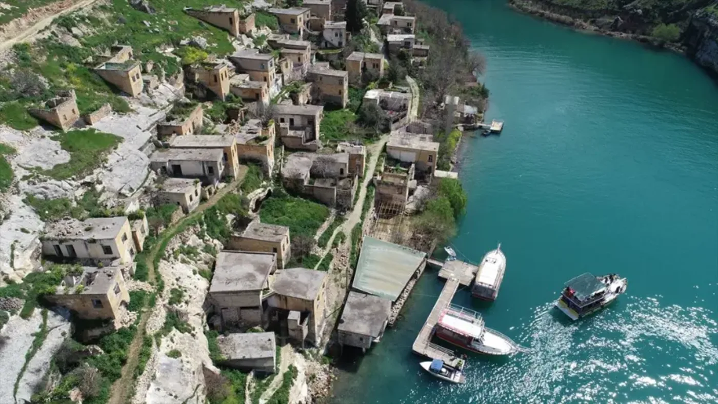
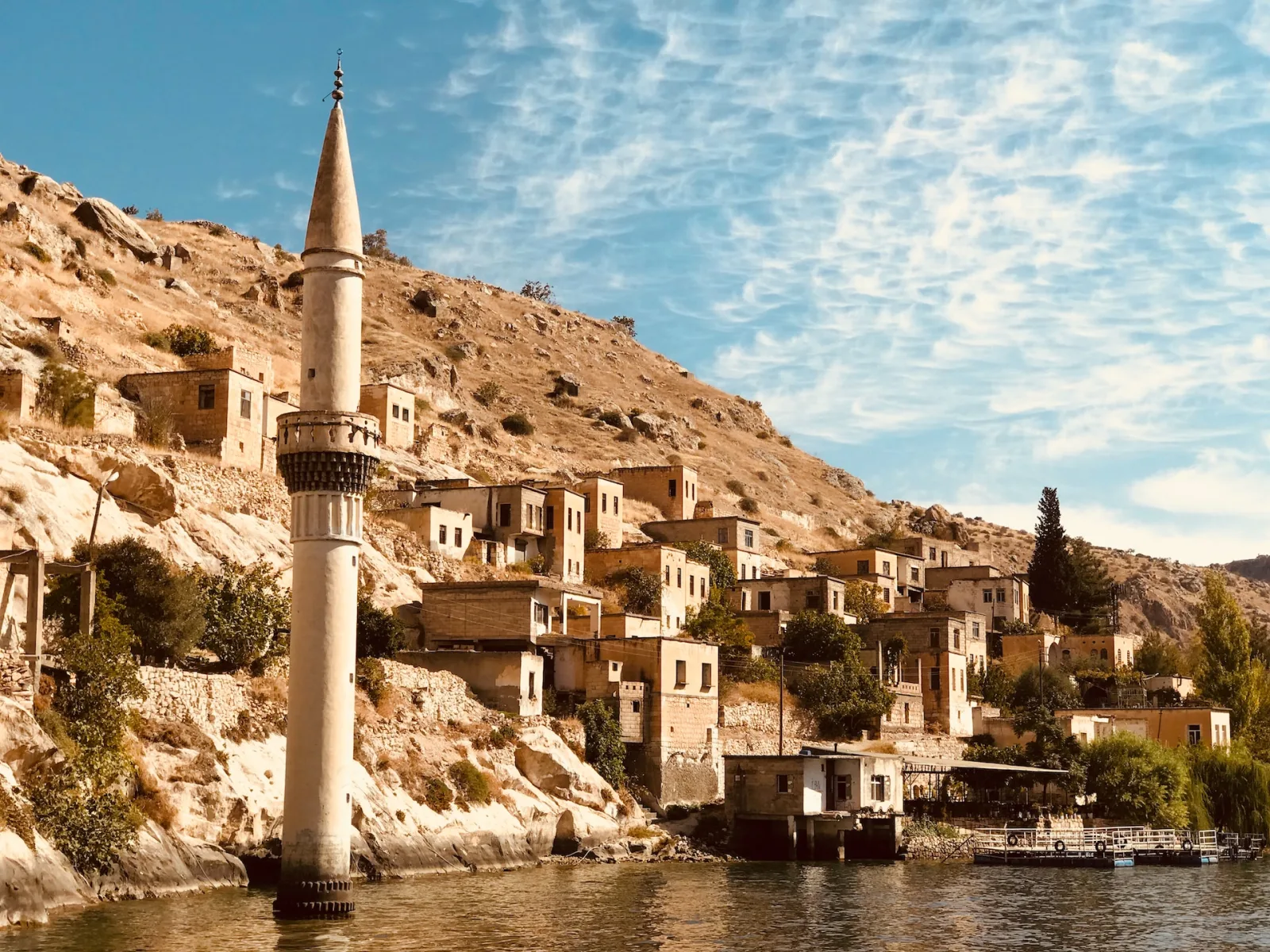
As painful a loss as this transformation was, it also gave the area an entirely different look. Streets that once ran along the riverbank now rise out of the water; boats moored at the shore can draw close enough to reach the windows of the old houses. The honey-colored stone houses arrayed along the slope, and the minaret at the water's edge, have turned Halfeti into one of Türkiye's most distinctive landscapes for photography and nature lovers. Before boarding the boat, sitting at one of the tea gardens along the shore and taking in this "sunken town" tableau makes for a fine start to the trip.
Savaşan Village and the Submerged Mosque
Shortly after the boat sets out onto the water, the most memorable image of the route appears: a mosque minaret rising alone from the middle of the water. This minaret is what remains of the underwater portion of the mosque in Savaşan Village, on the shore of the dam lake. Most of the mosque lies submerged; only its minaret and part of its body stay above the surface. With its reflection cast on the still water, this image has, over the years, become almost the emblem of Halfeti.
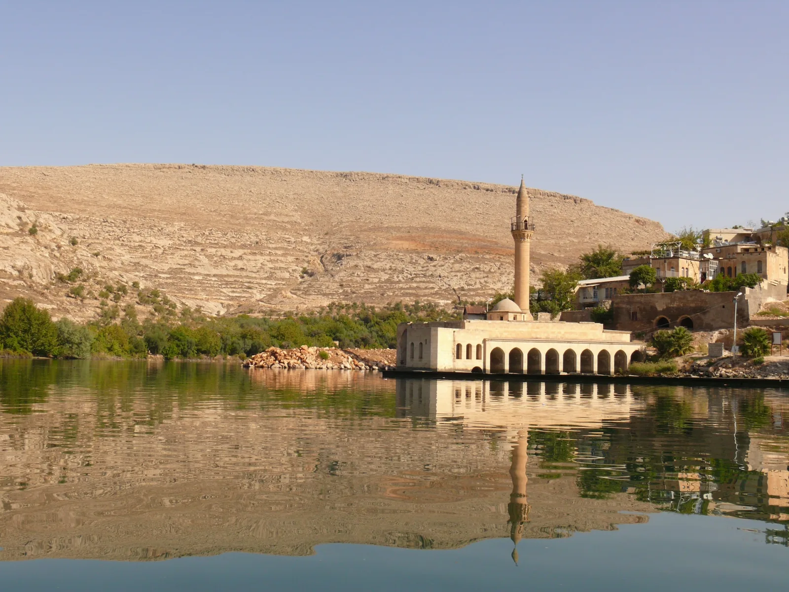
Savaşan is the most important stop on the boat tours. This is the spot where the boats glide slowly past the submerged minaret and visitors take in the structures beneath the water and the stone houses along the shore — for most people, the strongest memory of the entire trip. Many boats make a short stop here; it's a good chance to have a glass of tea at one of the plain tea gardens by the water and savor the view.
Halfeti's Black Rose
This route has another symbol, one with nothing to do with the water yet the one that made Halfeti known to the world: the black rose. In fact deep crimson in color, this rose grows so dark in the special soil and microclimate of Old Halfeti that it appears almost black to the eye. What's fascinating is that this darkness is unique to this place: when its saplings are moved elsewhere, they don't show the same color and revert to a lighter crimson. This rarity makes the rose one of the small but unforgettable details of a Halfeti trip.
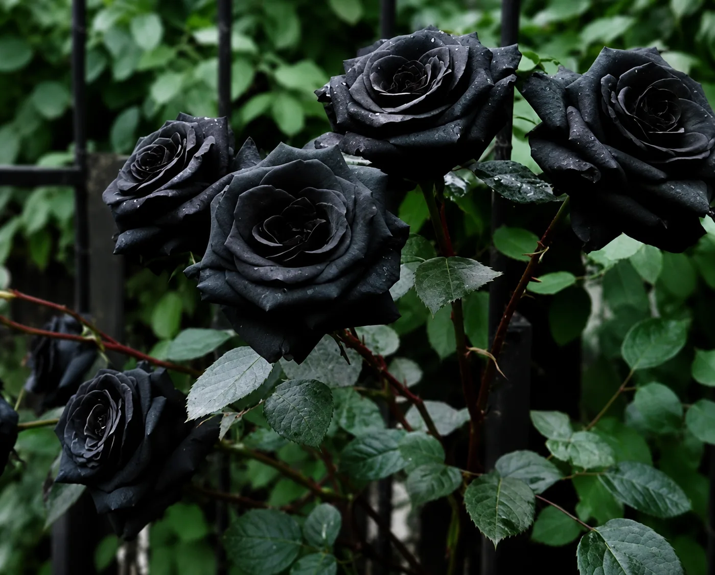
For those who want to see the black rose at its fullest, timing matters; the rose is generally at its most striking in spring, especially in April and May. This overlaps nicely with spring, which is already the ideal time for the Halfeti route.
The Green Waters of the Euphrates and the Riverside Nature
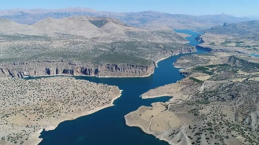
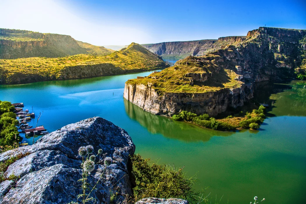
As you pass Savaşan and move on toward Rumkale, the landscape changes; settlement thins out, giving way to steep canyon walls and the Euphrates' own distinctive greenish waters. The Birecik Dam Lake has turned the fast-flowing river into a mirror-still surface of water in places; depending on the angle of the sun, the water takes on tones that shift from deep turquoise to emerald green. Here and there along the shore, willows, olive groves, and green slopes clinging to the rock come into view.
This section offers the calmest and most "nature-bound" side of the route. Apart from the sound of the engine, there is little noise; what remains is water, rock, and sky. As you round the river's bends, a rocky mass rising out of the water begins to appear on the far side — the climax of the route is drawing near.
Rumkale: The Fortress on the Rocky Headland
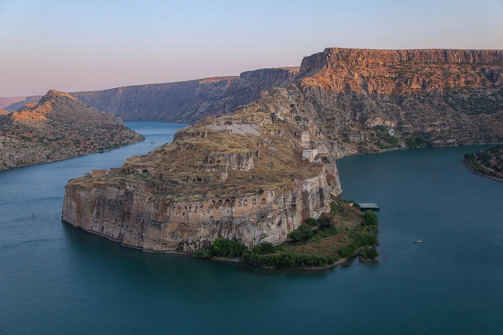
The route reaches its peak in front of Rumkale. The fortress rises on a steep rocky headland surrounded by water on three sides, at the point where the Merzimen Stream meets the Euphrates. Approached by boat, the fortress looks like a giant rock island emerging from the water; the hollows, openings, and traces of ruined ramparts on the surface of the rock reveal that the structure was largely shaped by carving into the stone. This is the most striking and most photographed frame of the whole route.
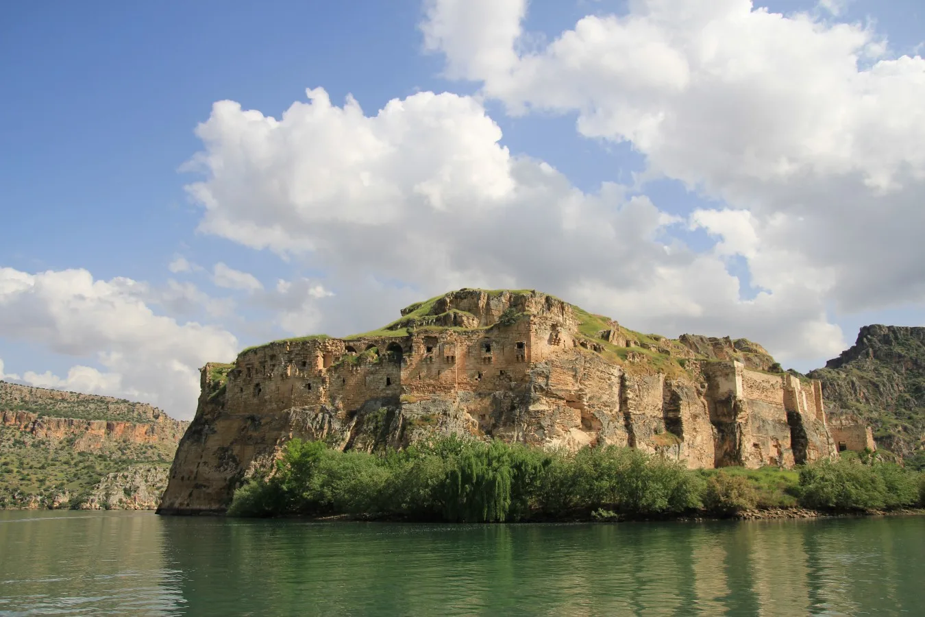
What makes Rumkale not just a view but a layered history is its past. The name means "the fortress of the Rums/Romans," and the structure carries overlapping layers reaching from Byzantium to the Crusaders, from the Mamluks to the Ottomans. Its most brilliant era, however, was as the religious center of the Armenian Church in the Middle Ages; known in Armenian sources by the name Hromgla, the fortress became identified with the poet and theologian Catholicos Nerses IV, who according to the sources died here in 1173. This Christian period closed with the Mamluk conquest at the end of the 13th century; Sultan al-Ashraf Khalil ibn Qalawun took the fortress on a date usually given as 1292 and gave it the name Qal'at al-Muslimin, meaning "the Fortress of the Muslims." To explore the fortress's history and its rock-cut church, monastery, and water system in more detail, you can take a look at the Rumkale page.
Transport, Duration, and Season: Realistic Tips
Knowing the geography helps when you're planning the trip. From Gaziantep city center to Old Halfeti it's roughly a one to one-and-a-half hour drive by road; the route turns off the Şanlıurfa highway toward Halfeti. Although Rumkale is administratively in Gaziantep's Yavuzeli district, the most practical access to the fortress — because of the rising waters — is not by land but by the boats leaving from Halfeti on the opposite shore. From the Old Halfeti pier, a journey of about half an hour along the river is enough to reach Rumkale.
The standard boat tour is generally a round trip of a few hours that sets out from Old Halfeti and takes in Rumkale and the submerged mosque at Savaşan; most tours make a short stop at Savaşan. Since current departure times, fares, and tour options can vary by season, it's best to confirm on site before you go.
The choice of season directly affects the experience. Spring and autumn are the most ideal periods in terms of both temperature and scenery; since temperatures in the region can climb quite high in summer, staying long on an open boat can be tiring. Spring is also an advantage for those who want to see the black rose. Early morning hours or the time near sunset are photographers' favorites, both for the light and for the cooler air.
A Pause in the Slow City of Halfeti
When the boat tour ends, don't rush. With its peaceful, unhurried fabric, Halfeti was admitted to the international Cittaslow (Slow City) network in 2013; this identity is given to settlements that protect local life, nature, and traditional character against rapid urbanization. In Halfeti, time flows slowly, like the still waters of the dam lake. The tea gardens and simple restaurants along the shore are made for a pleasant close to the trip.
This route is one of the loveliest ways to add a nature break to Gaziantep's dense gastronomy and history program. After touring the museums, bazaars, and kebab tables in the city center, descending to the banks of the Euphrates and spending a few hours on the water brings a whole new balance to the trip. For those who want to plan the region's other nature and culture stops together, the Culture Atlas is a good starting point; those curious about the ancient past of the riverbank can take a look at our Zeugma guide. If you have two days in the city, you can easily work this Euphrates tour into your Gaziantep in 48 hours plan.
Frequently Asked Questions
How long does it take to get from Halfeti to Rumkale by boat?
From the Old Halfeti pier, a journey of about half an hour along the river is enough to reach Rumkale. The standard round-trip tour covering Rumkale and the submerged mosque at Savaşan generally takes a few hours, and most tours make a short stop at Savaşan.
Can you reach Rumkale by land?
Because the Birecik Dam, commissioned in 2000, filled the valley around the fortress with water, road access to the fortress has largely come to an end. For this reason Rumkale is today mostly visited by boat tours leaving from Halfeti on the opposite shore, across the dam lake.
Are Halfeti and Rumkale in the same province?
No. Halfeti is a district tied to Şanlıurfa province; Rumkale, on the other hand, lies on the opposite side of the Euphrates, within the boundaries of Gaziantep's Yavuzeli district. The two complement each other on the two banks of the river and are generally visited together on the same boat route.
What is the submerged minaret in Savaşan Village?
The minaret rising alone from the middle of the water is what remains of the underwater portion of the mosque in Savaşan Village. Most of the mosque was submerged as the dam waters rose; only its minaret and part of its body stayed above the surface, and this image has become the emblem of Halfeti.
What is the best season for the Halfeti route?
Spring and autumn are the most ideal in terms of both temperature and scenery; in summer, temperatures in the region can climb quite high. For those who want to see the black rose at its most striking, spring — especially April and May — offers an added advantage.
What is Halfeti's black rose (siyah gül)?
The black rose is a deep crimson rose that grows this dark — appearing almost black to the eye — only in the special soil and microclimate of Old Halfeti. When its saplings are moved elsewhere it does not show the same darkness, and it is one of the region's best-known symbols.